
Bridging Reality and Digital Intelligence through Geospatial-AI
Our Services
At Temadigital, whether it’s sourcing existing solutions or crafting bespoke ones, we are dedicated to customising our approach to precisely meet the unique requirements of each client.
Data Automation
3d city modelling

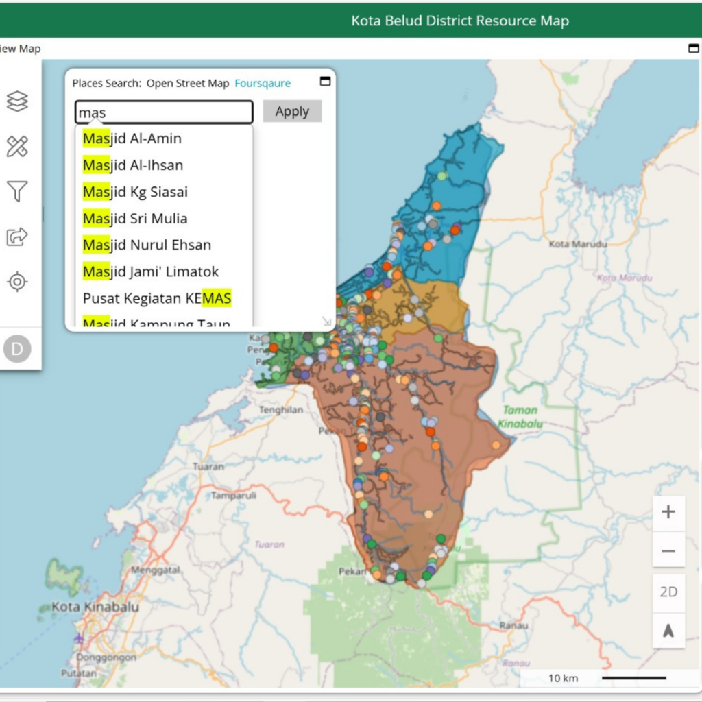
map dashboard
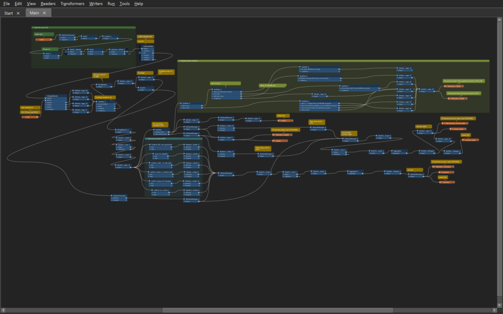
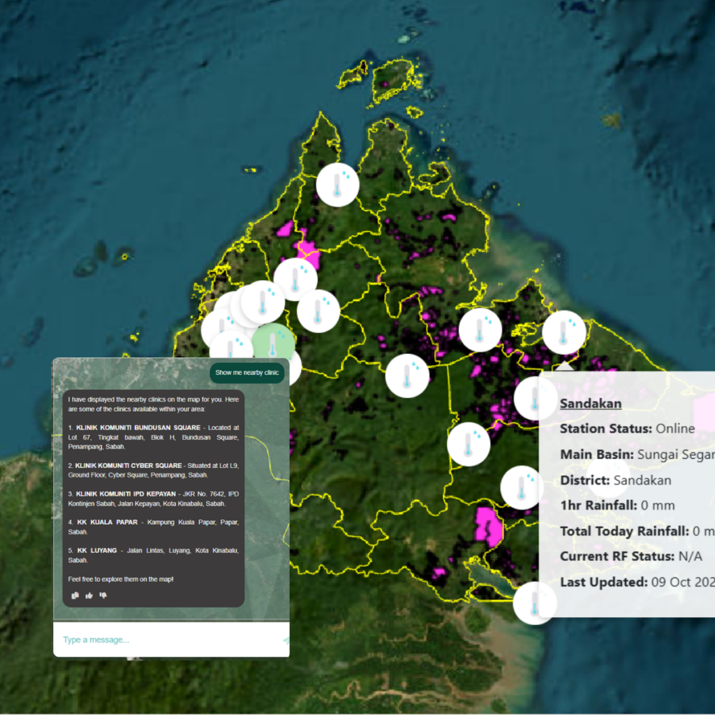
AI & gis application
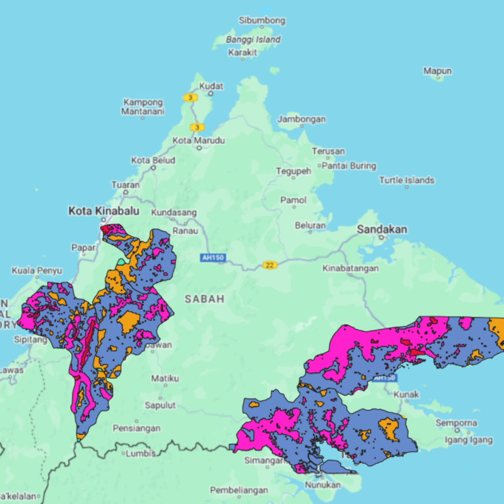
geospatial analysis
Clients and Partners
Our clients and partners include a diverse range of organizations, from government agencies to private sector companies, all relying on our geospatial expertise to drive innovation and achieve their goals


Latest Insights
Our clients and partners include a diverse range of organizations, from government agencies to private sector companies, all relying on our geospatial expertise to drive innovation and achieve their goals
-
-
GeoConnect Asia Exhibition
SINGAPORE – Temadigital collaborated with Get 3D Singapore during the GeoConnect Asia 2025 exhibition held at Marina Bay Sands Expo, Singapore, to showcase some of the latest solutions in geospatial…
-


Want to Learn How Geospatial Solutions Can Help?
Connect with us today to explore how we can help you grow and innovate